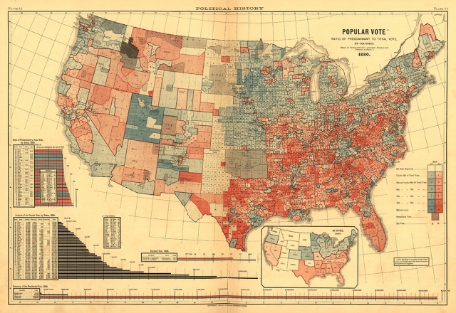
Historian Susan Schulten found this map of the 1880 election while leafing through the 1883 Statistical Atlas of the United States:
“That era was basically the last time the parties were as strong as they are now,” says Seth Masket, a political scientist at the University of Denver and colleague of Schulten’s. “We’re not talking about slavery or the aftermath of the Civil War,” he says, but “we are talking about fundamental ideological differences about what this country stands for.”
This was the era when a “solid South” emerged, although back then the parties were flipped, and white Southerners flocked to the then more conservative Democratic Party (in red on the map). The 1880 election, between Republican James Garfield and Democrat former Civil War general Winfield Scott Hancock, was remarkably close–with Garfield eking out the popular vote by the smallest of margins (48.3% vs. 48.2%). The biggest issue of…
View original post 113 more words

